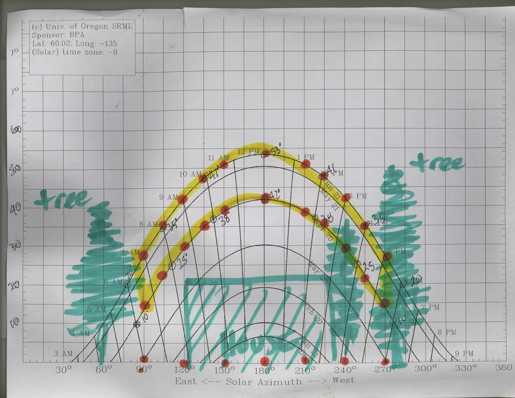
Whitehorse sun path (by date)
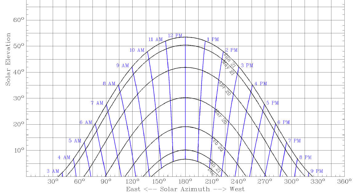
Note: The times on the chartThis graph shows the elevation and azimuth of the sun at different months of the year in Whitehorse. This information should be taken into consideration when designing a greenhouse. The angle of the glazing, the direction the greenhouse faces, the glazing materials and the length of time you wish to operate your greenhouse are all affected by this information.
How to use this chart.
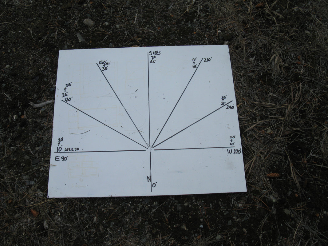
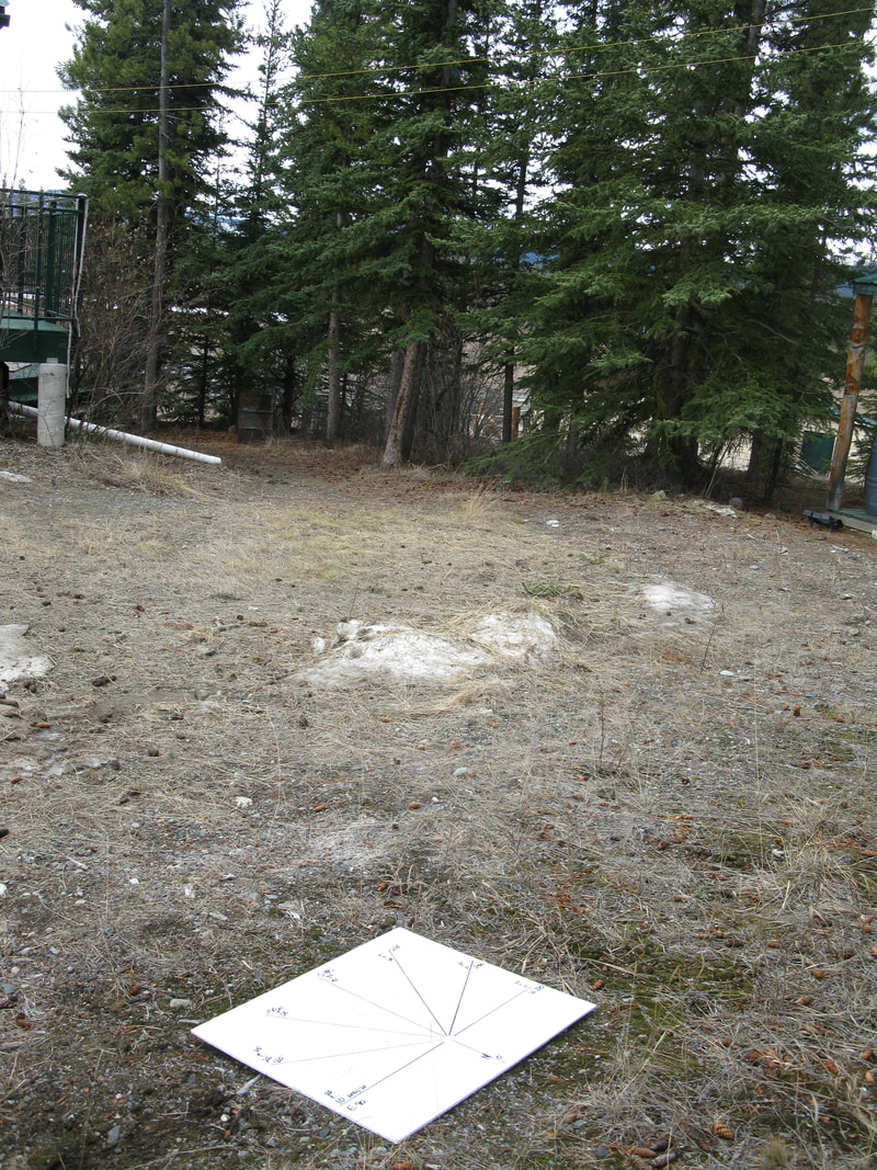
Mark out, on a large sheet (plywood), a baseline that you line up with East (90 Deg) and West (270 deg). In the middle of this line, run a perpendicular line pointing South (180 deg). Between the 90 Deg and 180 deg, draw lines from the intersection point at 120 deg, 150 deg, 210 deg, and 240 deg. See the diagram below. Note: The times on the chart are solar times where 12 noon is the high point of the suns arc. In Whitehorse that is 1 pm.
How to use this chart.
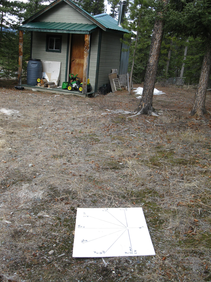
Mark out, on a large sheet (plywood), a baseline that you line up with East (90 Deg) and West (270 deg). In the middle of this line, run a perpendicular line pointing South (180 deg). Between the 90 Deg and 180 deg, draw lines from the intersection point at 120 deg, 150 deg, 210 deg, and 240 deg. See the diagram below. Note: The times on the chart are solar times where 12 noon is the high point of the suns arc. In Whitehorse that is 1 pm.
|
|
|
|
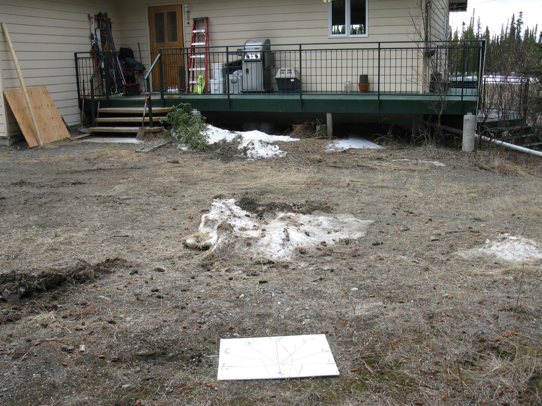
Find the angle to the top of objects that may cast a shadow on the greenhouse location. This is the solar elevation. On a sheet of paper draw a diagram with base showing a line from east to west. See the sketch below. Move to different locations to find the best place for your greenhouse.